ESOEXO
2021
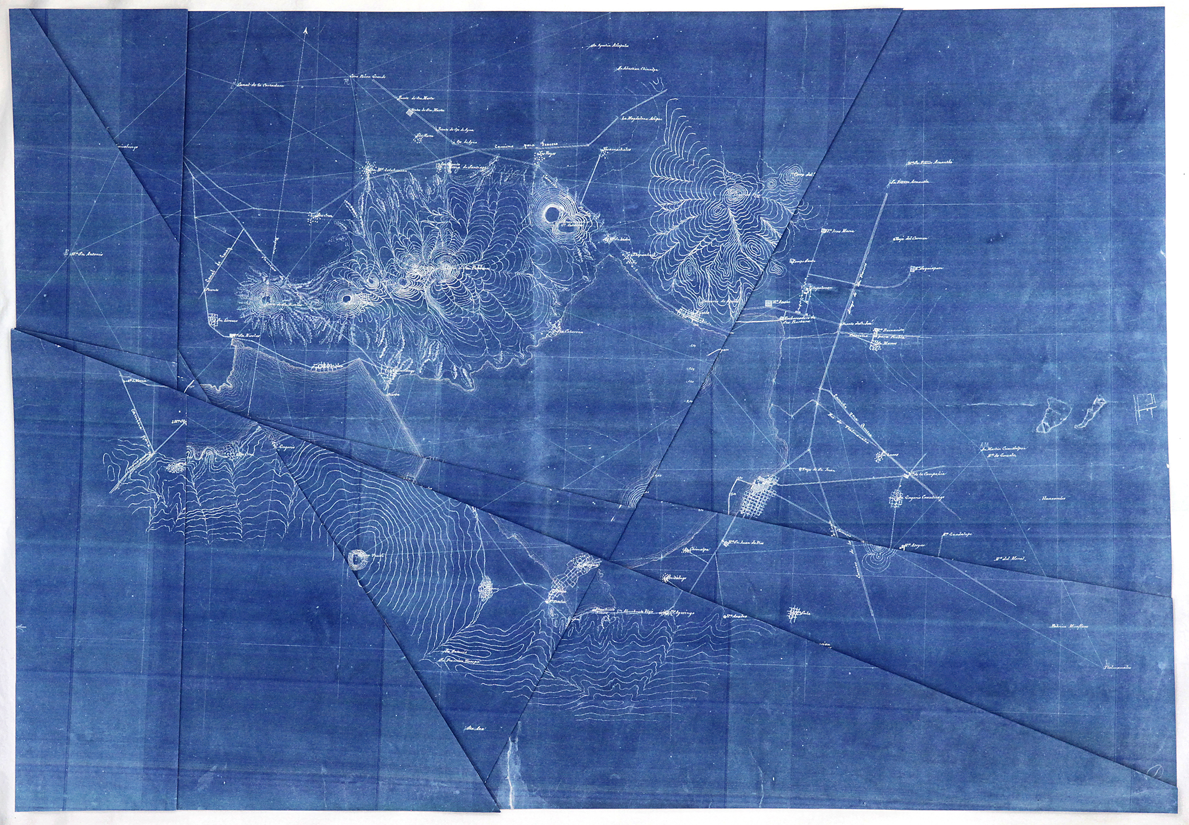
Sketch of the lakes of Chalco and Xochimilco drawn up by the Commission of the Valley of Mexico, 1867, inkjet print, Blueback paper, 91 x 70 cm, folded
Federal District / Sketch of Xochimilco, 3 colour silkscreen print, 20 x 25 cm, framed without glass
Sketch of the canals that link Lake Texcoco with those of the southern Valley of Mexico, inkjet print, 60 x 55 cm, framed without glass
General Directorate for the Cadastre / Municipality of Xochimilco / Polygon network, single colour silkscreen print, 73 x 70 cm, framed without glass
General Directorate for the Cadastre / Municipality of Xochimilco / Plan of all the sections, single colour silkscreen print, 89 x 70 cm, framed without glass
Plan of the communal lands of the town of San Gregorio Atlapulco / Municipality of Xochimilco D.F., single colour silkscreen print, 70 x 70 cm, framed without glass
with the support of - AIR Antwerpen, [R.A.T.] Mexico City, Vlaamse Gemeenschapscommissie, SOFAM, Eté78
|
Esoexo is a series of prints on paper based on digitized historical maps from the Mapoteca Manuel Orozco y Berra, a governmental archive for maps, technical archives and measuring instruments in Mexico City. These historical documents map the geography of the valley of Mexico City, in origin a land of lakes, over the centuries; from the pre-Columbian waterways of the district of Xochimilco to the expansion of the city under European colonisation, an era marked by drainage, a growing transportation network and urbanisation.
Besides the original marks of wear and tear, recent digital artifacts such as scan lines or pixelisation came to appear aspiring to preserve these maps. All marks, artifacts and folding lines manifest themselves as archaeological layers, making up a complex reading of history. Through digital color inversion, the use of different printing techniques, deviant ways of folding, and other manipulations I search for methods and interventions to reactivate this archive and decolonise the landscape. The maps are cleared from lines representing the traces and history of European imperialism, for example canals of drainage and roads. As a result of these translations historical information is being hidden, erased, blurred, marked, included or excluded and ultimately turned into an alternative topography recalling a point in history before the landscape was subject to European influence. Such alternative topographies imagine a new, potential reality which opens the way to rethink history.
|
|
|